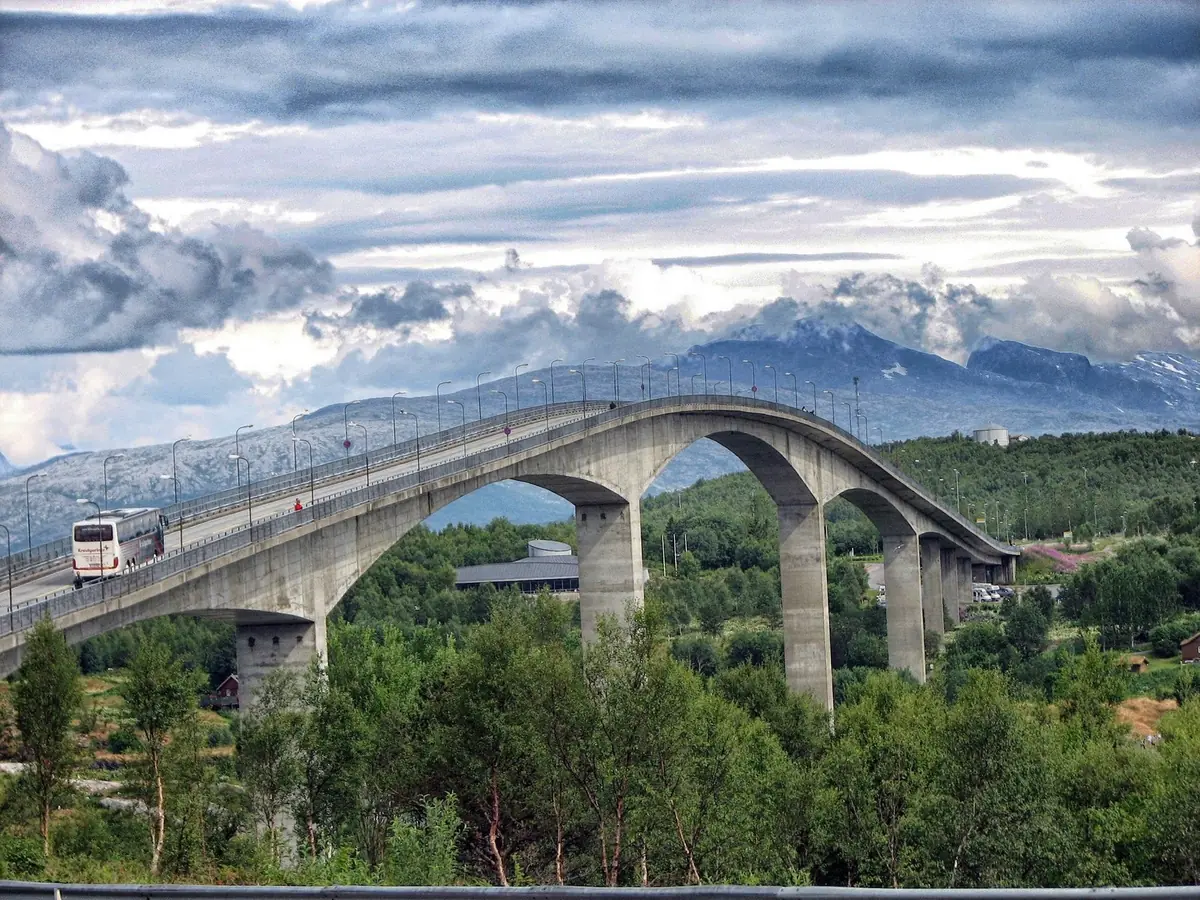
24.1 Where the Helgeland Coast Meets Bodø
The northern part of Helgeland offers a final transition between the island world and Bodø.
This region combines: historic fishing communities, offshore islands, glaciers and mountains, white-sand beaches, sea-eagle country, powerful tidal waters, scenic coastal roads, express-boat travel.
The two islands of Støtt and Bolga, the wider Meløy region and Saltstraumen make an excellent final section of a Helgeland journey before continuing to Bodø.
24.2 Støtt — A Historic Trading Post
Located offshore from Ørnes, Støtt is one of the most atmospheric island communities on the northern Helgeland coast.
Its identity is closely connected to its former role as a fishing village and trading post.
Today, historic buildings have been preserved and adapted for accommodation, dining and tourism.
The result is a destination where visitors can experience traditional coastal architecture without giving up modern comforts.
24.3 Exploring Støttvær
The small archipelago around Støtt is ideal for slow exploration.
Possible activities include: walking, cycling, kayaking, fishing, boat trips, RIB excursions, snorkelling, diving, beach visits.
Sheltered coves, skerries and white-sand beaches create a landscape that feels much more remote than its distance from the mainland suggests.
24.4 Staying on Støtt
Støtt – Top of Helgeland offers accommodation in restored historic buildings and operates the Restaurant Gammelbutikken.
The restaurant focuses heavily on local seafood and ingredients from the surrounding coast.
The property is open year-round, making Støtt one of the more practical remote-island destinations for travellers interested in both summer and winter experiences.
24.5 Støtt in Summer
Summer brings: Midnight Sun, kayaking, cycling, fishing, beaches, birdlife, boat excursions.
The long daylight makes it possible to explore without rushing.
A simple Støtt day could be: breakfast → island walk → kayak → seafood lunch → beach → late-evening photography.
24.6 Støtt in Winter
Støtt also offers a very different winter experience.
The island can be used as a base for: Northern Lights, winter coastal photography, fishing, snow activities, mountain excursions, quiet island stays.
Visit Helgeland promotes Northern Lights experiences at Støtt from approximately September through May.
Winter weather can, however, affect boat schedules, so flexibility is essential.
24.7 Bolga — A Small Island with a Big View
Bolga lies in Meløy municipality and is one of the smaller inhabited islands in this part of the coast.
Its defining feature is Bolgfjellet, a mountain rising to roughly 338–339 metres.
The island is surrounded by a maze of islands, islets and skerries.
From the mountain, clear-weather views can extend across a huge section of the Helgeland archipelago.
24.8 Bolgtinden and Bolgbørra
The hike to Bolgtinden is short but challenging.
Key facts: elevation approximately 338m, distance approximately 2.5km one way, elevation gain approximately 337m, time about 1–2 hours one way, main season approximately May–October, difficulty challenging.
The upper section contains exposed terrain, ropes and some light scrambling.
The nearby Bolgbørra cave is another attraction, but its steep approach requires care.
The important lesson is that a low mountain is not necessarily an easy mountain.
24.9 Bolga by Kayak
The waters around Bolga are relatively sheltered in places and are suitable for kayaking when conditions permit.
The combination of clear water, small islands, beaches, skerries, mountain scenery makes the area particularly attractive from sea level.
Guided kayaking is preferable for visitors without appropriate experience.
24.10 Bolga Brygge
Bolga Brygge provides accommodation, dining, boat facilities and opportunities for fishing and kayaking.
The island has only around two kilometres of road, so a car is rarely necessary for a normal visitor.
This makes Bolga particularly suitable for: boat arrival → hike → kayak → seafood → overnight stay.
24.11 Meløy — Mountains Behind the Islands
The wider Meløy region connects the outer islands with a dramatic mainland landscape.
Here, the scenery changes from low islands → fjords → steep mountains → glaciers.
The region is therefore useful as a transition between island tourism and inland mountain experiences.
The municipality also provides access towards Svartisen, Norway's second-largest glacier, which has already been covered in earlier Helgeland chapters.
For this chapter, the focus is on how Meløy connects the island network with Bodø.
24.12 Ørnes — The Island-Hopping Hub
Ørnes is an important mainland transport point for the northern Helgeland islands.
From here, travellers can connect to destinations including: Støtt, Bolga, other islands, Bodø, southern Helgeland.
Visit Helgeland currently lists both local express-boat services and the Nordlandsekspressen (NEX) as key connections.
For travellers without a car, Ørnes can therefore function as a practical base for exploring the outer islands.
24.13 The Northern Helgeland Island Network
A useful mental map is: Bodø → Ørnes → (Støtt and Bolga) → Rødøy/other islands → Southern Helgeland.
Actual routes and departure patterns vary by season.
Always check the current timetable before booking accommodation.
24.14 Saltstraumen — Where the Sea Moves
Near Bodø lies one of Norway's most remarkable tidal phenomena: Saltstraumen.
Powerful tidal flows move enormous quantities of seawater through the narrow strait connecting Saltfjorden and Skjerstadfjorden.
The phenomenon changes with the tide, so the exact conditions vary throughout the day.
24.15 Seeing Saltstraumen
From land — visitors can observe the water from viewpoints around the bridge and shoreline.
By boat — RIB excursions provide a much closer experience of the current. Some tours combine Saltstraumen with wildlife watching, including the possibility of seeing sea eagles.
By kayak — experienced paddlers can explore the wider area, but the strongest current zones should not be approached casually. Tide knowledge and appropriate local guidance are essential.
24.16 Why Tide Timing Matters
Saltstraumen is not equally dramatic at every moment.
The strength of the current changes as the tide moves in and out.
Therefore: check the tide timetable before planning your visit.
This is especially important for boat trips, photography and kayaking.
24.17 Sea Eagles and Wildlife
The waters around Saltstraumen and northern Helgeland support abundant marine life.
Possible sightings include: white-tailed sea eagles, seabirds, seals, fish, porpoises.
Wildlife is unpredictable, so sightings should always be treated as a possibility rather than a guarantee.
24.18 The Helgelandskysten Scenic Route
The official Norwegian Scenic Route Helgelandskysten runs approximately 433 km between Holm and Godøystraumen, with a detour to Torghatten.
It is the longest of Norway's 18 Scenic Routes.
The route includes six ferry crossings and passes through an extraordinary mixture of mountains, fjords, glaciers, islands and coastal landscapes.
The northern section provides the natural connection between Meløy, Saltstraumen and Bodø.
24.19 A Route for Slow Travel
The Scenic Route should not be treated as a simple distance calculation.
Ferries, viewpoints and weather can substantially affect journey time.
The official Scenic Routes authority specifically recommends allowing plenty of time because of the six ferry crossings and the variety of experiences along the route.
A useful mindset: distance tells you where you are going; ferry schedules determine when you arrive.
24.20 Cycling the Northern Coast
The Helgelandskysten route forms part of National Cycle Route 1 and EuroVelo 1.
However, the entire route is a demanding cycling journey.
There are also long tunnels, and cycling is prohibited through the Svartis Tunnel, requiring an alternative route or ferry.
Cyclists should therefore plan individual stages rather than assuming the complete route can be comfortably covered in a few days.
24.21 A Three-Day Northern Helgeland Journey
Day 1 — Bodø → Saltstraumen: arrive in Bodø, travel to Saltstraumen, explore viewpoints, check the tide, optional RIB experience, overnight near Saltstraumen.
Day 2 — Saltstraumen → Meløy → Støtt: travel north along the coast, continue to Ørnes, express boat to Støtt, explore Støttvær, seafood dinner, overnight on Støtt.
Day 3 — Støtt → Bolga → Bodø: if boat schedules allow — morning Støtt exploration, travel to Bolga, short island walk or viewpoint, continue towards Bodø.
This itinerary depends heavily on seasonal boat schedules and should be treated as a framework rather than a fixed timetable.
24.22 Five-Day Northern Helgeland Journey
- Day 1: Bodø and Saltstraumen.
- Day 2: Saltstraumen → Meløy → Ørnes.
- Day 3: Støtt.
- Day 4: Bolga.
- Day 5: Return towards Bodø.
This slower version allows more time for weather changes and island exploration.
24.23 Best Experiences by Destination
| Saltstraumen | tidal current & sea wildlife | ½–1 day. |
|---|---|---|
| Ørnes | transport hub & mainland base | ½ day. |
| Støtt | historic island life & seafood | 1–2 days. |
| Bolga | hiking, kayaking & views | 1–2 days. |
| Meløy | mountains, coast & glacier access | 1–2 days. |
24.24 Best Time to Visit
May–June — spring landscapes, longer daylight, hiking season beginning, fewer visitors than peak summer.
July–August — Midnight Sun, best overall island-hopping conditions, hiking, kayaking, cycling, more tourism activity.
September–October — autumn colours, darker evenings, Northern Lights opportunities increase, fewer visitors.
November–April — Northern Lights, winter coastal scenery, quiet island communities, more weather and transport uncertainty.
24.25 Food and Local Character
Northern Helgeland is strongly connected to the sea.
Expect opportunities to experience: fresh fish, stockfish, seafood, local ingredients, traditional coastal dishes.
Støtt is particularly notable for its historic trading-post setting and seafood-focused dining.
On small islands, opening hours may be seasonal, so dining should be planned together with transport.
24.26 Photography Guide
- Støtt: historic trading-post buildings, harbour, white beaches, fishing boats, Midnight Sun.
- Bolga: Bolgtinden, Bolgbørra, archipelago panoramas, kayaks, mountain-and-sea compositions.
- Meløy: mountains, glaciers, fjords, coastal roads.
- Saltstraumen: tidal currents, bridges, sea eagles, RIB boats, long-exposure water photography.
A telephoto lens is useful for wildlife; a wide-angle lens works well for the large coastal landscape.
24.27 Practical Travel Strategy
Build the journey in this order: 1. Check boat timetable. 2. Reserve accommodation. 3. Check weather and sea conditions. 4. Plan hikes and activities. 5. Add photography stops.
Do not reverse this order.
A beautiful hiking plan is useless if the only boat leaves before you finish the hike.
24.28 Responsible Island Travel
The communities of northern Helgeland are small and infrastructure is limited.
Visitors should: respect local residents, keep noise low, take rubbish with them, respect private property, keep dogs under control near wildlife, avoid disturbing nesting birds, follow local boating rules, stay on appropriate trails, support local accommodation, food and activity providers.
The same principle applies throughout the Helgeland coast: travel slowly, spend locally and leave no trace.
24.30 Suggested Routes
Main route: Bodø → Saltstraumen → Ørnes → (Støtt and Bolga) → Meløy coastal route.
24.31 Check Before You Go
NEX timetable, Ørnes–Støtt service, Ørnes–Bolga service, ferry departures, vehicle/bicycle rules, Saltstraumen tide times, RIB departure times, Bolgtinden trail conditions, winter ice conditions, accommodation availability, restaurant opening dates, weather and sea conditions, road conditions.
The Norwegian Scenic Routes website describes the route, and Visit Helgeland lists boat connections. Check both for your actual travel dates.
24.32 Quick Reference
Main gateway: Bodø. Tidal phenomenon: Saltstraumen. Island hub: Ørnes. Historic island: Støtt. Hiking island: Bolga. Main mountain on Bolga: Bolgtinden. Major scenic road: Helgelandskysten. Main transport: ferry + express boat. Best summer feature: Midnight Sun. Best winter feature: Northern Lights. Ideal duration: 3–5 days.
24.33 Final Takeaway
Northern Helgeland provides a fitting final chapter to the island section of the Helgeland coast.
At Saltstraumen, the sea becomes the attraction. At Støtt, coastal history remains alive. At Bolga, a short but challenging mountain climb opens into an enormous island panorama. Around Meløy, the landscape grows from low islands into glaciers and mountains.
And finally, the journey naturally leads towards Bodø, one of Northern Norway's major gateways.
The key to travelling here is simple: do not rush the coast. Let the boats, weather, islands and changing light determine the rhythm of the journey.